
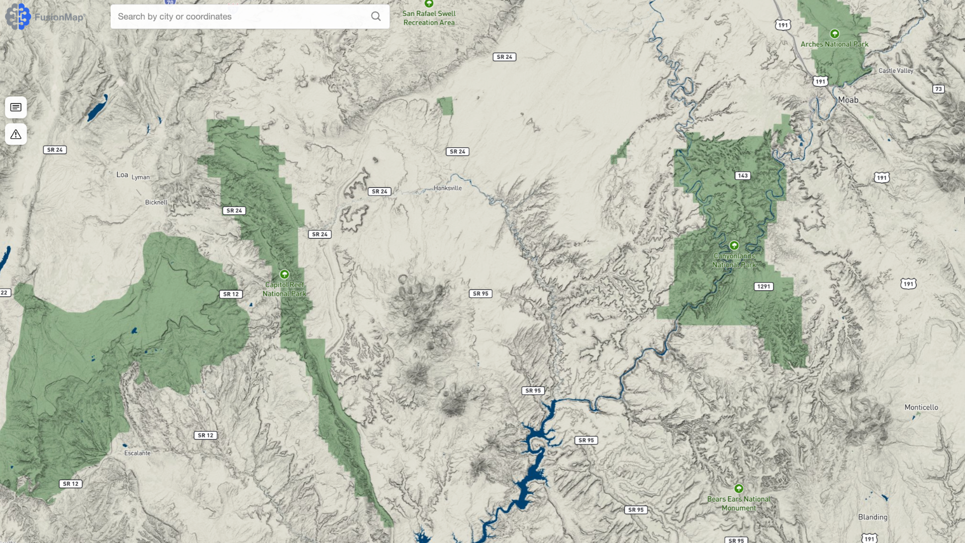
Organizations today face an unprecedented volume of spatial data—from drone imagery and LiDAR to field photos, documents, and environmental layers. But collecting data is only half the challenge. The real value comes from transforming it into clear insights that drive faster, safer, and more confident decisions.
FusionMap was built for exactly this purpose. It brings together geospatial visualization, AI-powered analysis, real-time collaboration, and enterprise scalability into one modern platform. For teams working in infrastructure, transportation, mining, environmental management, defense, or emergency response, FusionMap provides capabilities that other systems simply cannot match.
Here’s why FusionMap is worth adopting—and why it’s quickly becoming the platform organizations rely on to modernize their workflows.
1. It Centralizes All Your Geospatial Data in One Place
Most organizations juggle a mix of tools to view images, explore LiDAR, read field notes, or analyze spatial trends. FusionMap eliminates this fragmentation by consolidating:
Imagery and panoramic photos
LiDAR and point clouds
Geotagged inspections
AI detections and measurements
Premium environmental layers
Notes, documents, and reports
This unified environment reduces complexity, eliminates redundant workflows, and ensures everyone—from field teams to executives—uses the same accurate, up-to-date information.
2. Built-In AI That Massively Reduces Manual Work
FusionMap is more than a viewer—it’s an intelligent platform with enterprise-ready AI features, including:
Pulse AI
A conversational assistant that retrieves insights from notes, alerts, measurements, and even uploaded PDFs. Users save time searching, learning, or navigating complex layers.
Asset Analyzer
Automates the detection of signs, poles, guardrails, manholes, markings, and more—converting imagery and LiDAR into rich, structured asset inventories.
Airfield AI™ & Facade AI™
AI-driven defect detection for runways, infrastructure, and building exteriors—improving accuracy and reducing inspection time.
These solutions replace hours of manual reviewing, eliminating human error and accelerating project delivery.
3. Industry-Ready Tools for Real Operational Impact
FusionMap is engineered for real-world workflows across sectors such as transportation, disaster response, mining, asset management, defense, and geohazard monitoring.
Examples include:
Transportation: AI detects roadway assets and defects, enabling proactive maintenance and safer operations.
Disaster Response: Before/after comparisons and live field updates help teams respond faster and communicate impact clearly.
Mining: Track pit boundaries, haul roads, and terrain changes with precision.
Geohazards: Monitor landslides, floods, and terrain shifts using LiDAR and Premium Layers.
FusionMap adapts seamlessly to both routine operations and high-stakes missions.
4. Advanced Visualization—Made Easy
FusionMap includes specialized viewers and analysis tools that elevate understanding:
Split View for precise change detection
Camera, LiDAR, and Hybrid Viewers for 2D/3D inspection
Height Profiles, In-Viewer Measurements, LAS subset exports, and more
These tools allow users to explore complex data with clarity—without needing specialized software or technical expertise.
5. Analytics Built In: FusionLens
Most geospatial platforms stop at visualization. FusionMap goes further with FusionLens, a built-in analytics environment that replaces external BI tools like Tableau or Looker.
Teams can generate:
Condition dashboards
Asset summaries
Performance metrics
Inspection analytics
—all without exporting data or paying for additional software.
6. Premium Layers Without Premium Hassle
Instead of relying on multiple paid subscriptions, FusionMap’s Premium Layers provide access to 29+ authoritative datasets from NASA, ESA, OpenWeatherMap, and EOX—directly within the platform.
Users get richer insights without the overhead of managing external systems.
7. Designed for Field-to-Office Connectivity
With FusionMap’s iOS app, field teams can:
Capture geotagged photos
Upload data in real time
View and update project information
Synchronize instantly with office colleagues
This eliminates data-transfer delays and keeps projects moving at full speed.
8. Enterprise-Scale Uploading with Fusion Cloud
Large LiDAR projects often struggle with browser upload limits.
Fusion Cloud solves this by allowing bulk uploads of thousands of LAS files directly to Azure Blob Storage—saving time and removing operational bottlenecks.
9. Faster, Clearer, and More Informed Decision-Making
Ultimately, FusionMap delivers what decision-makers need most:
A complete, accurate view of assets and environments
Faster analysis powered by AI and built-in tools
Seamless collaboration across stakeholders
Greater confidence in reporting and planning
Reduced operational costs and field hours
It’s not just a mapping platform—it’s an intelligence platform.
The Bottom Line: FusionMap Gives You an Operational Advantage
Whether you’re overseeing infrastructure, managing assets, inspecting facilities, responding to disasters, or planning for future risks, FusionMap equips your team with the clarity and intelligence required to act decisively.
It reduces complexity.
It improves accuracy.
It accelerates workflows.
It connects your organization.
And it does all of this in one integrated platform.
FusionMap is how modern teams move from data-heavy to insight-driven.




Comments are closed