

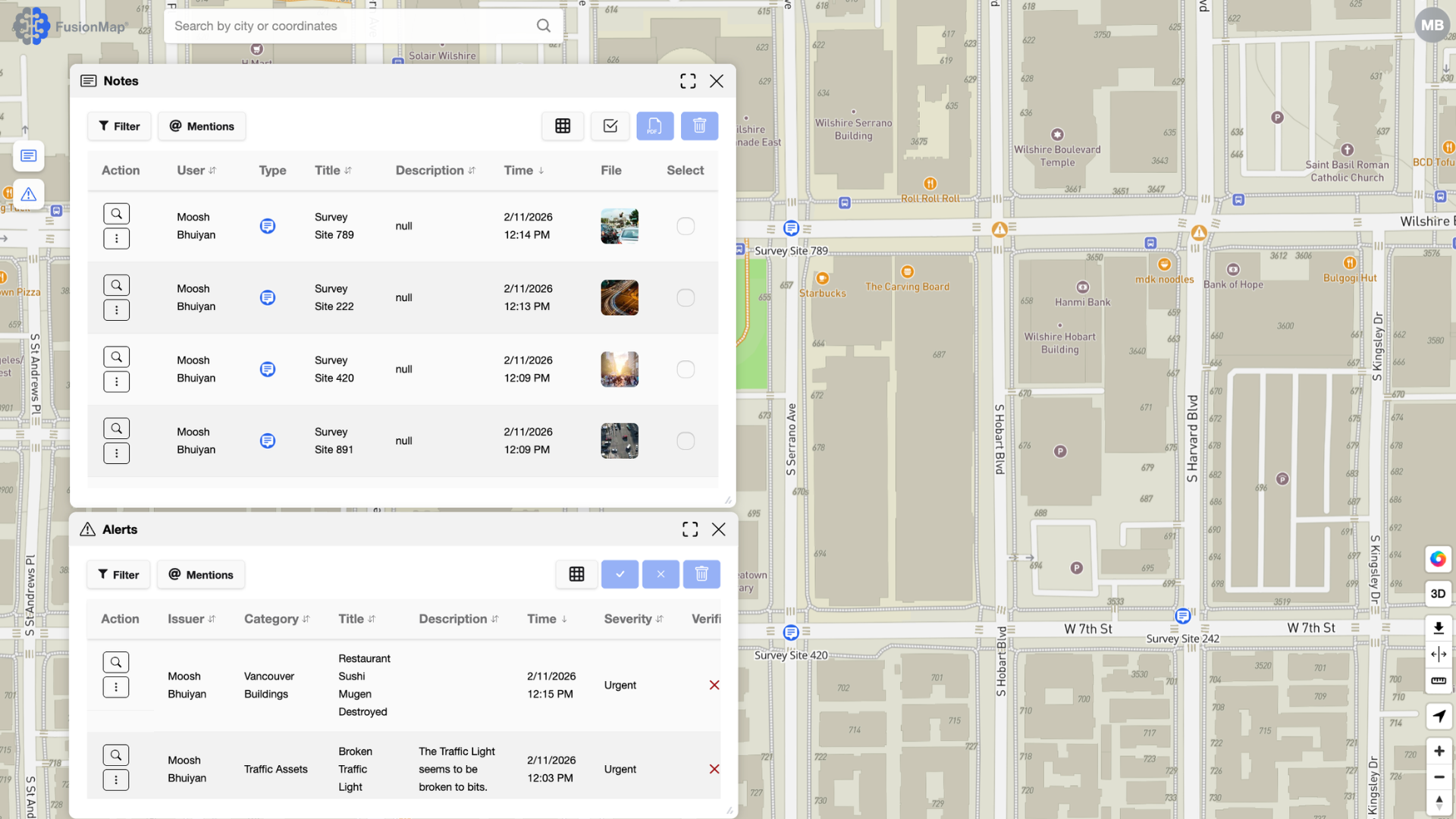
In an era where infrastructure, environmental change, and urban growth evolve faster than traditional workflows can keep up, organizations need a platform that brings clarity to complex spatial data. FusionMap is that platform—an integrated geospatial ecosystem built to help teams visualize, analyze, and act on real-world data with unprecedented speed and accuracy.
Whether you’re managing transportation assets, conducting airfield inspections, responding to disasters, or assessing geohazards, FusionMap centralizes the data you rely on and enhances it with powerful AI-driven capabilities.
A Single Platform for All Your Geospatial Workflows
FusionMap unifies imagery, LiDAR, panoramas, documents, and analytics into one intuitive interface. Instead of juggling separate tools, teams operate from a single source of truth, improving collaboration and decision-making across entire projects.
Built-In AI That Accelerates Workflows
FusionMap includes a suite of integrated AI solutions designed to automate time-consuming tasks, reduce manual labor, and improve accuracy:
- Pulse AI – A conversational assistant that provides instant answers from project notes, alerts, measurements, and even PDFs. No steep learning curve—Pulse AI helps users find insights immediately.
- Airfield AI™ – Automates runway crack detection and surface assessment using high-resolution imagery and LiDAR.
- Facade AI™ – Analyzes building exteriors for cracks, spalling, corrosion, and other defects using advanced vision models.
- Asset Analyzer – Automatically detects and maps signs, poles, manholes, guardrails, and other infrastructure assets from LiDAR and imagery.
These AI features significantly reduce field time, enhance safety, and deliver consistent, defensible inspection data at scale.
Powerful Tools for Visualization and Analysis
FusionMap includes tools that make spatial analysis clearer, faster, and more accessible:
- Premium Layers – Access 29+ authoritative layers from NASA, ESA, OpenWeatherMap, and EOX through one subscription. No need for multiple vendors.
- Split View – Effortlessly compare datasets or time periods to detect change or track deterioration.
- FusionLens – Create integrated charts, graphs, and dashboards directly inside FusionMap—eliminating the need for external BI tools.
- Tours – Visualize geotagged images and panoramas on the map, synced with LiDAR for deeper inspection context.
- Ranges – Generate isochrone layers for coverage planning, emergency response, and logistics optimization.
- LiDAR, Camera, and Hybrid Viewers – Explore static photos, panoramic imagery, and point clouds individually or side-by-side, complete with measurement tools, height profiles, notes, and subset exports.
These features make FusionMap not only a visualization platform, but a decision-support environment.
Field and Office Connected—In Real Time
With the FusionMap iOS app, field teams can:
- Capture and upload data on-site
- Add geotagged photos and notes
- Sync observations instantly with office teams
This real-time link eliminates delays, reduces data transfer friction, and supports continuous project momentum.
Fusion Cloud: Designed for Enterprise-Scale Data
Large LiDAR datasets no longer create workflow bottlenecks.
Fusion Cloud enables teams to upload thousands of LAS files directly to Azure Blob Storage, bypassing browser limitations and maintaining enterprise-grade reliability.
Built for a Wide Range of Industries
FusionMap supports critical workflows across multiple sectors:
- Transportation: AI detection of road assets like signs and manholes; centralized monitoring for road, rail, and transit systems.
- Disaster Response: Rapid before/after analysis for floods, fires, landslides, and storms.
- Asset Management: AI-tagged inventories, condition tracking, and reporting dashboards.
- Mining: Terrain tracking, pit boundary monitoring, and compliance workflows.
- Geohazard Assessment: LIDAR-driven detection of terrain shifts, flood risks, and landslide exposure.
- Defence: Airfield inspections and infrastructure oversight for operational readiness.
Why FusionMap Matters
In a world defined by data volume, pace of change, and the need for rapid decision-making, FusionMap delivers:
- Clarity — Unify all spatial data into one intuitive environment
- Efficiency — Reduce field time, automate analysis, and streamline reviews
- Collaboration — Keep teams aligned with real-time synced maps and notes
- Scalability — Support large datasets and multi-stakeholder workflows
- Intelligence — Leverage AI capabilities built specifically for geospatial work
FusionMap isn’t just another mapping tool—it’s a modern platform for geospatial intelligence, engineered to empower smarter, faster, and safer decisions.





Comments are closed