
Features
Pointclouds & Imagery
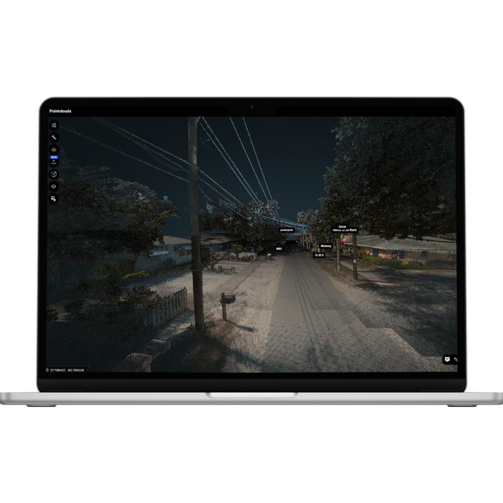
Experience high-precision LiDAR combined with imagery in a single immersive environment, no tool switching.
- Unified view: LiDAR and pano/video together
- Precise analysis: Measure and inspect with confidence
- Smooth navigation: Effortless switching between 2D, 3D, and hybrid views
AI, Custom & Base Layers
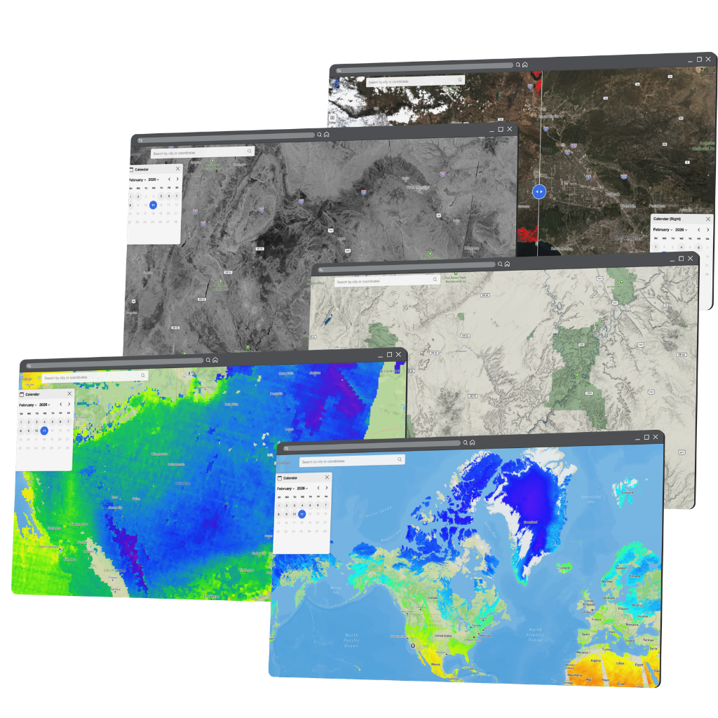
Work with a wide range of dynamic layers in one place – from user-uploaded data to advanced AI-powered insights—rendered seamlessly at scale.
- Flexible Layers: Upload and manage many layer types
- Dynamic rendering: Real-time styling and visibility control
- AI-powered layers: Premium insights with built-in intelligence
FusionLens
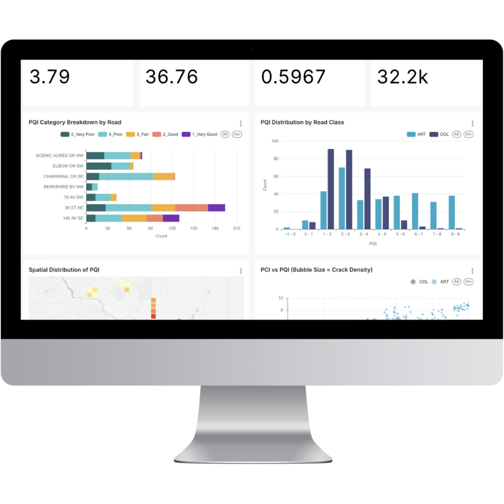
Turn geospatial data into actionable intelligence with built-in dashboards, charts, and visual analytics—no external BI tools required.
- Integrated analytics: Build charts, graphs, and dashboards directly inside FusionMap
- Cost-efficient insights: Eliminate the need for third-party BI platforms like Tableau or Looker
- Spatially connected reporting: Visualize asset health, trends, and performance within the same geospatial environment
Split View
Work with a wide range of dynamic layers in one place – from user-uploaded data to advanced AI-powered insights—rendered seamlessly at scale.
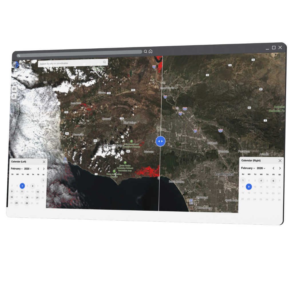
- Compare two layers using an interactive split-view tool
- Drag the divider to reveal differences between layers
- Drag the divider to reveal differences between layers
Collaborative Platform
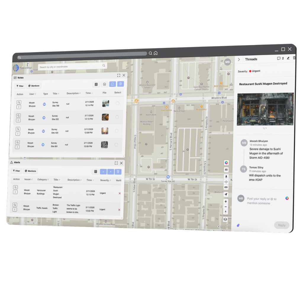
Centralize communication, documentation, and decision-making directly within your geospatial environment.
- Notes: Create and pin notes directly to assets, coordinates, or 3D environments
- Alerts: Notify teams instantly when issues are identified or thresholds are triggered
- Threads: Keep conversations tied to specific locations, assets, and inspections
Pulse AI
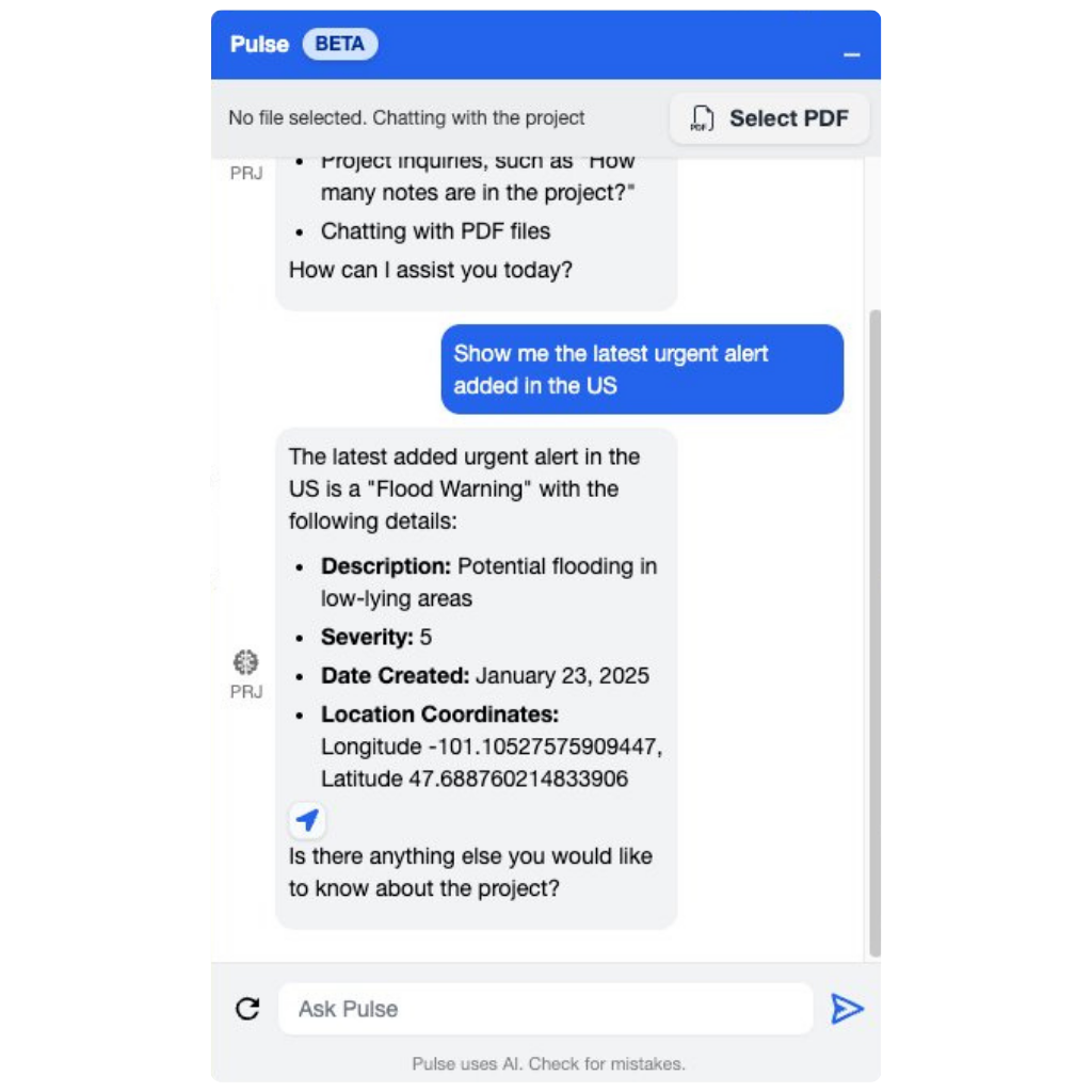
Your intelligent assistant inside FusionMap—delivering instant answers, contextual insights, and smarter workflows across every project.
- Document interaction built-in: Upload PDFs and reports, then extract insights through simple conversational prompts
- Ask. Instantly know. Query notes, measurements, alerts, and uploaded documents using natural language
- Platform-aware intelligence: Pulse understands FusionMap’s structure, tools, and project data—no training required
BIM Integration
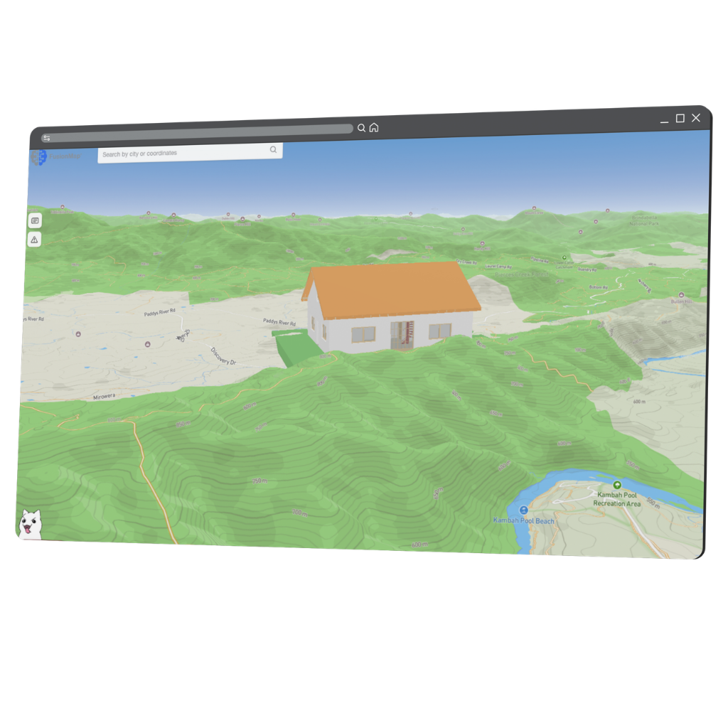
Bring intelligent 3D building models into FusionMap—complete with metadata, structure, and interactive control.
- Import rich 3D models: Upload detailed BIM files containing structural components and embedded metadata
- Interactive building control: Toggle layers like roofs, floors, or systems on and off for focused analysis
- Measure and annotate in 3D: Take precise measurements and attach notes directly within the building model

iOS App
Take FusionMap into the field with full access to your projects—capture, update, and collaborate in real time from your mobile device.
- Field-to-office continuity: Access maps, assets, and project data directly from your iPhone or iPad
- Real-time updates: Upload imagery, add notes, and sync changes instantly across teams
- Mobile data capture: Collect geospatial data on-site without interrupting workflows

FusionMap transforms complex data into meaningful maps that make insights easy to explore and share.





Designed with ❤️ by Moosh.