
Geospatial
Intelligence.
Simplified.
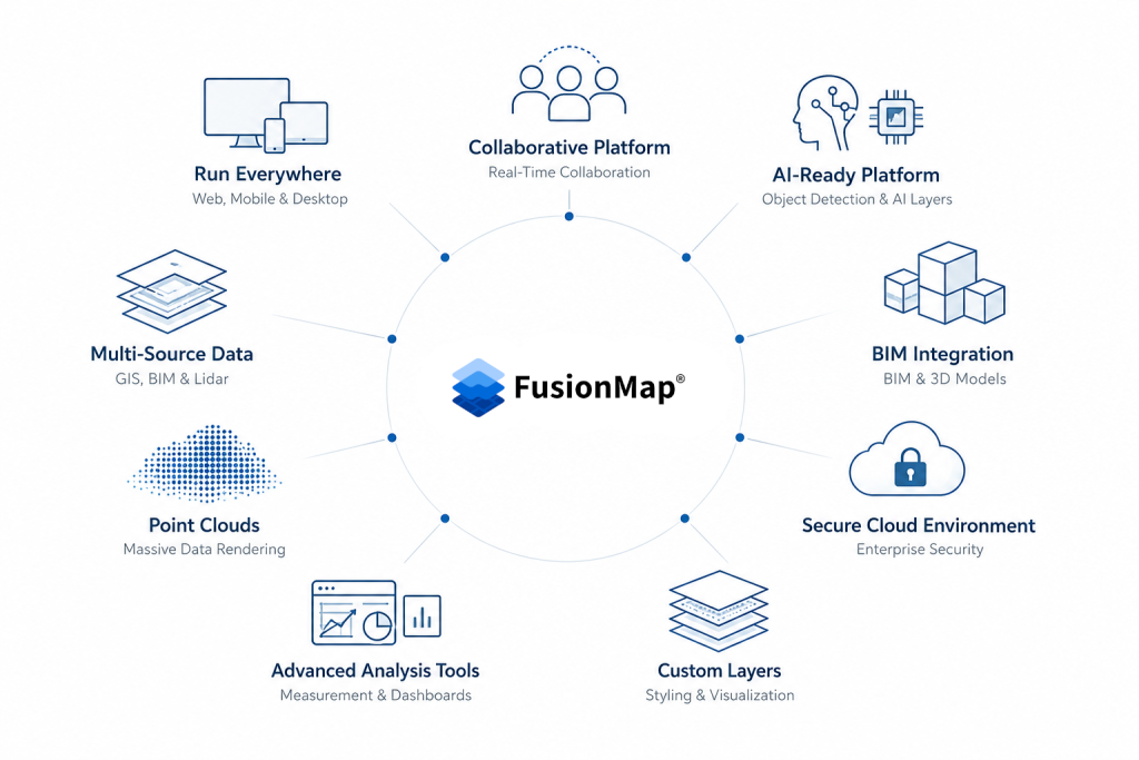
FusionMap unifies GIS, LiDAR, and AI tools in one platform, so you can visualize, analyze, and share real-world data with accuracy and speed.
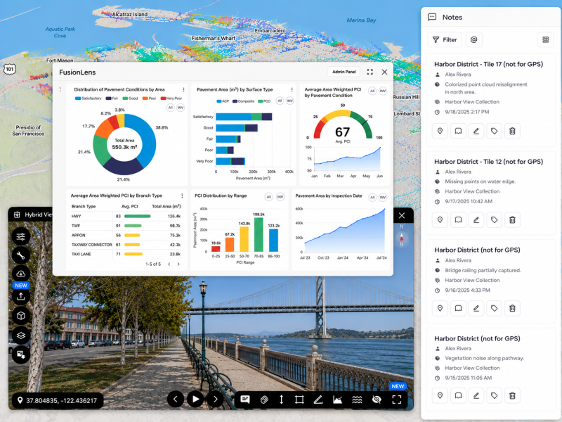
Powering organizations with data-driven insight







Explore FusionMap’s Core Capabilities
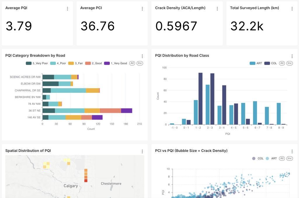
Gain deeper insights with FusionLens Dashboard
FusionLens turns complex geospatial data into intuitive, real-time insights displayed through an interactive dashboard.
- Monitor performance, usage, and data activity in one unified view
- Discover patterns and make smarter, data-backed decisions instantly
Smart Layers, Smarter Insights
Uncover deeper insights with AI-powered, detailed, and custom layers.
- Blend real-world data with AI intelligence for deeper insight
- Customize views to focus on what matters most
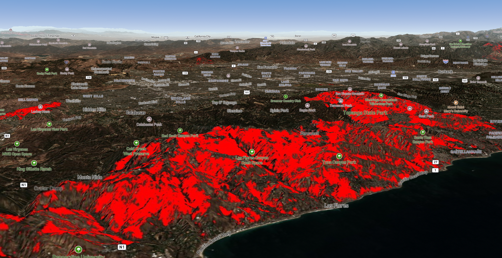
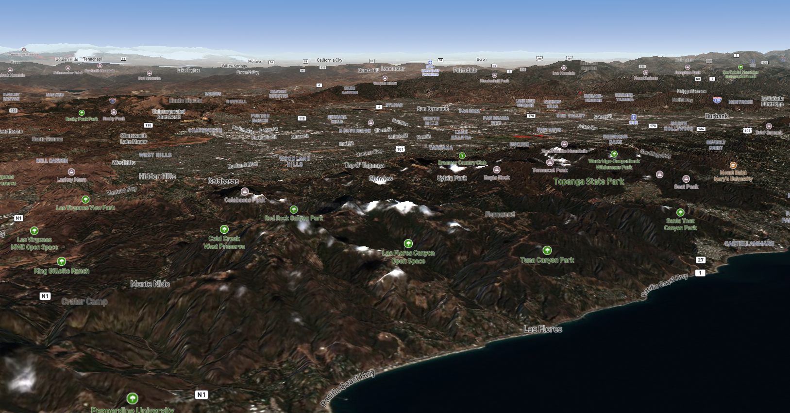
Los Angeles Wildfires, January 2025 – burned area before and after (as seen in FusionMap)

Office Room Scan using our iOS app
3D Modelling, Pointclouds & Digital Twins
Transform raw data into immersive, accurate 3D environments that bring your projects to life.
- Convert LiDAR and imaging data into interactive 3D scenes
- Visualize and explore infrastructure, terrain, and assets in interactive 3D
Decision-Makers Platform
A centralized platform that turns complex geospatial data into clear, actionable insights for confident decision-making.
- A secure, collaborative geospatial platform that runs everywhere
- Cut through complexity with intuitive tools that surface what matters most
Industry Solutions
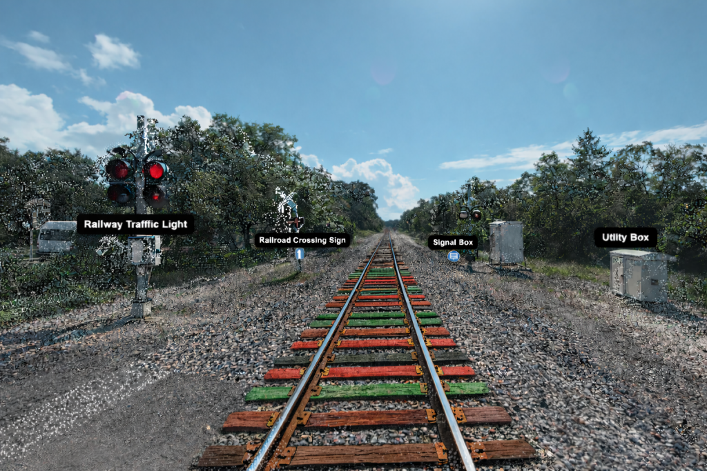
Transportation and Infrastructure
FusionMap helps transportation and infrastructure teams manage roads, rails, utilities, and public assets in a centralized, AI-powered geospatial platform, reducing downtime, improving safety, and enabling faster, better-informed decisions.
- AI-driven asset detection & tagging – Signs, poles, utilities and more
- Faster inspections – Less time in the field, more actionable insight
- Condition tracking – Visual records to monitor change over time
- Field and office teams fully synced in one platform
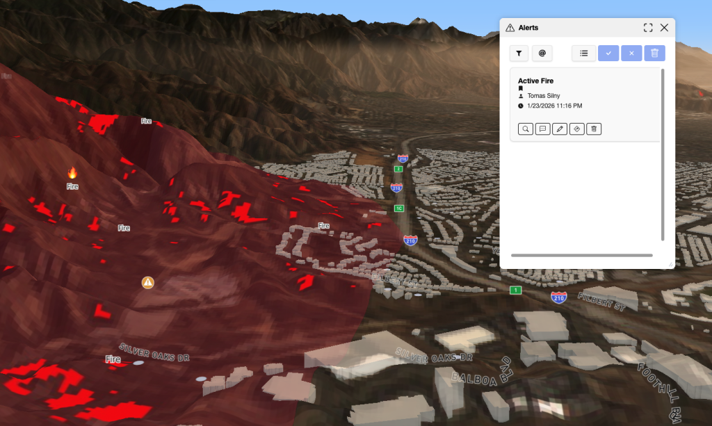
Disaster Response and Geohazards
FusionMap enables teams to detect, monitor, and respond to geohazards and disaster events using AI, LiDAR, and imagery. With before-and-after analysis, real-time field updates, and risk visualization, teams can assess impact faster, plan proactively, and respond with confidence.
- AI-powered risk detection – Flood zones, landslides and more
- Visual risk overlays – Map hazards and vulnerable areas
- Planning – Mitigate risk and prepare before disasters strike
- Before/after analysis – Instantly visualize change and damage
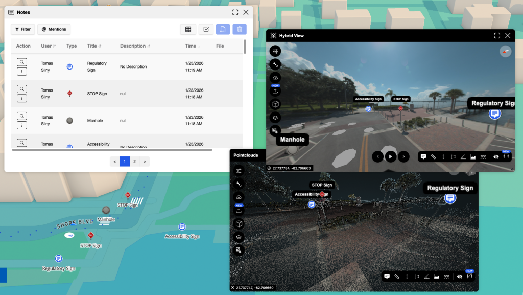
Asset Management
FusionMap simplifies asset inventories with AI-tagged detection, visual condition tracking, and interactive dashboards enabling smarter forecasting and reporting across your portfolio.
- Auto-tag assets – AI detects and classifies key infrastructure
- Track condition – Visual records over time
- Dashboard insights – Analyze trends and share updates
Airfields
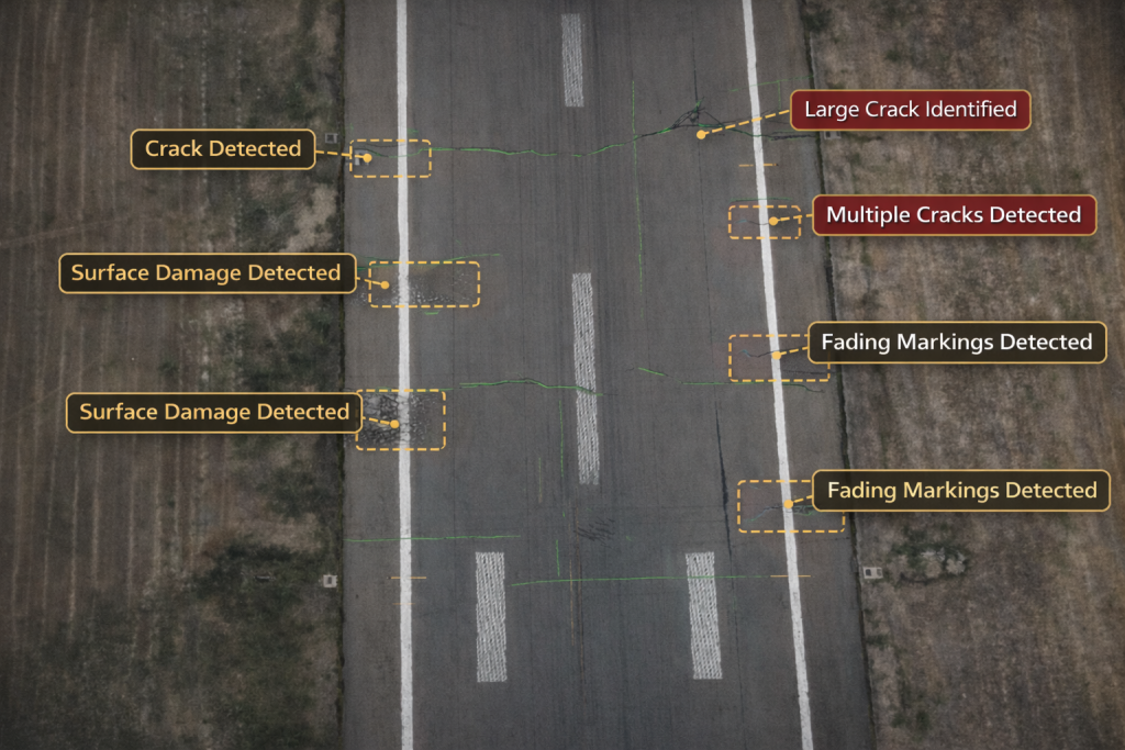
FusionMap with Airfield AI™ automates runway inspections by detecting cracks and surface damage from drone or vehicle imagery, enabling safer, faster, and more consistent maintenance without disrupting operations.
- Airfield AI™ – Automated crack and defect detection
- Time-based tracking – Monitor degradation over time
- Centralized oversight – All data in one mission-ready map
Mining
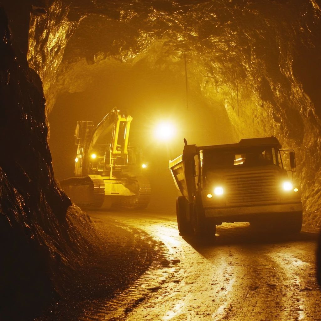
FusionMap supports mining operations from exploration to reclamation with terrain monitoring, haul road tracking, and compliance-ready inspection tools—all in one geospatial platform.
- Track terrain – Monitor pit boundaries and elevation changes
- Streamline inspections – Document conditions and safety risks
- Support compliance – Maintain audit-ready visual records
What You Can Do With FusionMap
Frequently Asked Questions
I want to try FusionMap. What should I do?
You can request access or a demo directly through FusionMap Contact Form below. Our team will help you get set up, upload your data, and explore the platform with your use case in mind.
How does FusionMap use AI?
FusionMap uses AI to automatically analyze imagery and geospatial data, helping identify patterns, surface issues, and features that would otherwise require manual inspection. FusionMap also includes AI-powered map layers and an integrated data analysis tool called Pulse, available directly within the map.
What kind of data can I use with FusionMap?
FusionMap works with a wide range of geospatial data formats, including GeoJSON, Shapefiles, WMS, WMTS, WFS, DXF, GeoTIFFs, ArcGIS services, KML, point clouds, panoramic imagery, and other imagery sources.
Who is FusionMap for?
FusionMap is built for infrastructure owners, engineers, inspectors, and operators who need a faster, more consistent way to understand and manage geospatial data.
Do I need special hardware to use FusionMap?
No special hardware is required to use FusionMap. FusionMap runs entirely in the browser with fast, dynamic rendering designed to handle large datasets efficiently. The platform is also available on mobile through our dedicated apps, enabling access to data both in the field and in the office.
Have a question?
Whether you’re curious about FusionMap, want to schedule a demo, or discuss how it could support your workflows, we’re here to help.
Fill out the form on the right and share a bit about what you’re looking for. Our team will review your message and reach out shortly to continue the conversation.

FusionMap transforms complex data into meaningful maps that make insights easy to explore and share.





Designed with ❤️ by Moosh.