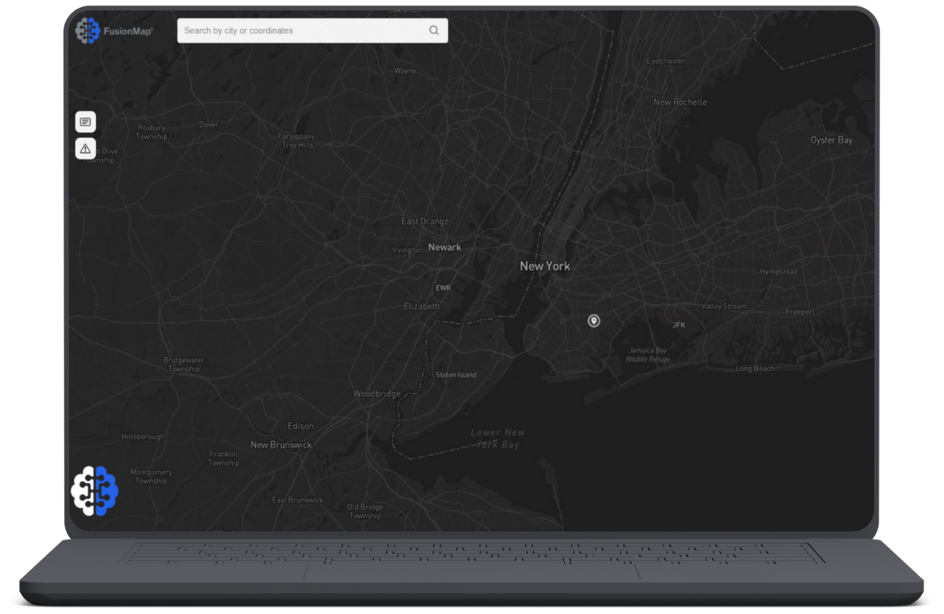
Designed With Your Mission in Mind
FusionMap isn’t just about powerful data—it’s about making your work easier, faster, and more connected. Every feature is built to help your team collaborate effortlessly, make confident decisions, and stay aligned from the field to the office. Because when your tools work for you, your impact goes further.
Explore Our Features!
Pulse AI
Your AI assistant in FusionMap—ask questions and get instant insights from project notes, alerts, measurements, and PDFs.

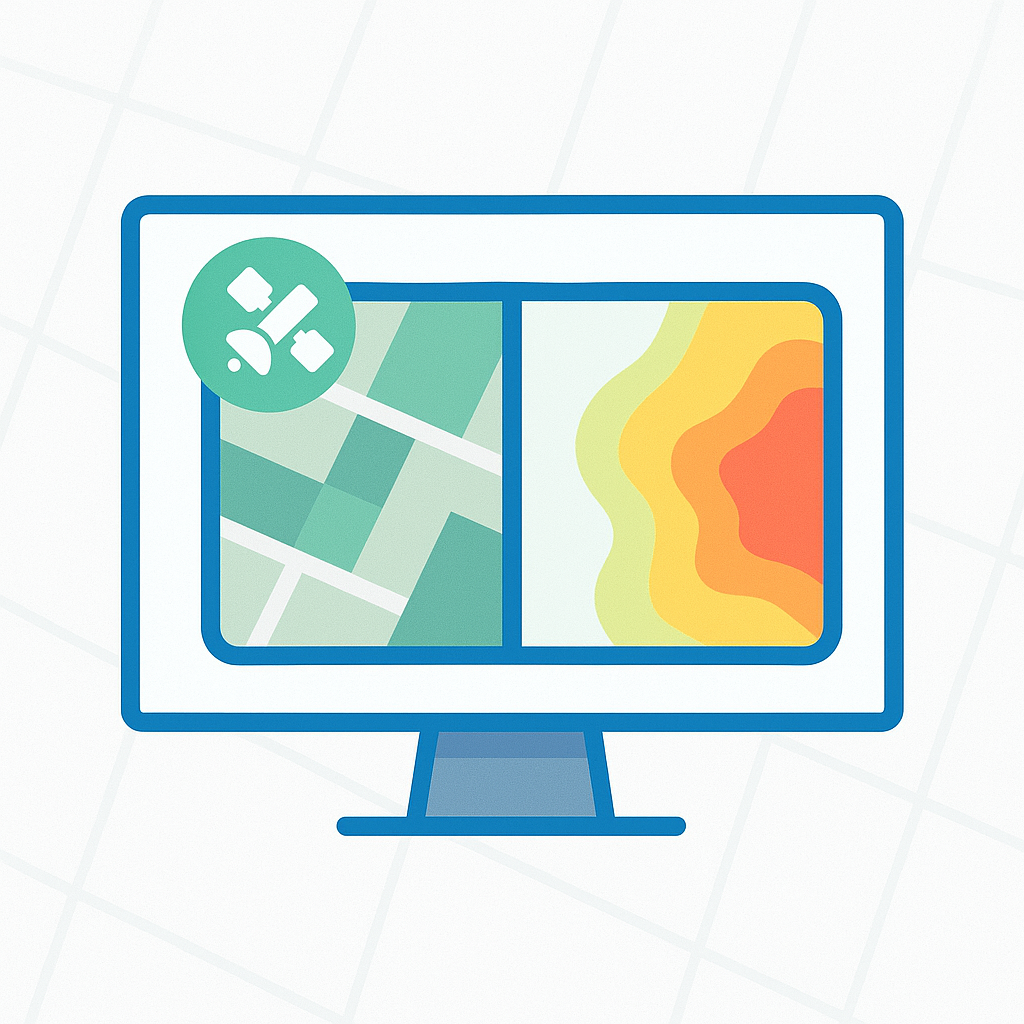
Split View
Split the screen to compare different datasets, timeframes, or layers side by side. Spot changes, analyze trends, and gain insights without having to switch tabs.
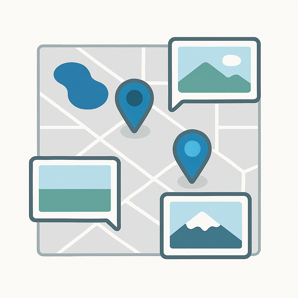
Tours
Upload and view your own camera or panoramic images directly on the map. Each image appears as an interactive point you can click to explore or download.

Pro Layers
Get near real-time, high-resolution satellite imagery to monitor environmental changes, geo-hazards, and infrastructure projects. Layers include:
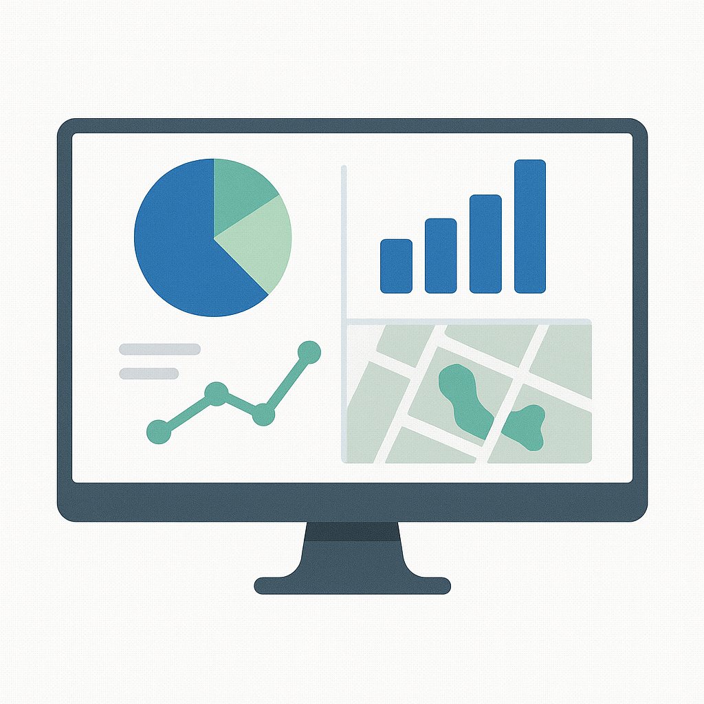
FusionLens
Turn project data into visual dashboards. With FusionLens, you can create custom charts, graphs, and summaries to track trends, monitor asset health, and share insights—right from your map.

Mentions
Tag teammates in notes, alerts, and replies to keep collaboration focused and ensure the right people see the right updates.
Asset Detection
Automatically detect and tag objects like signs, utility poles, and manholes within a 3D point cloud to streamline asset identification and management.

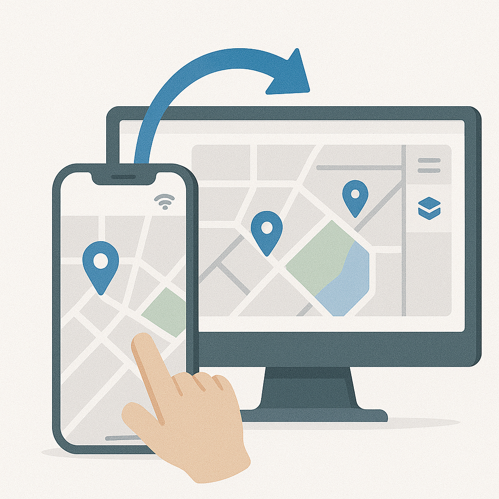
iOS App Support
Access FusionMap on the go with our iOS app. Seamlessly view, interact with, and update your maps directly from your iPhone or iPad.
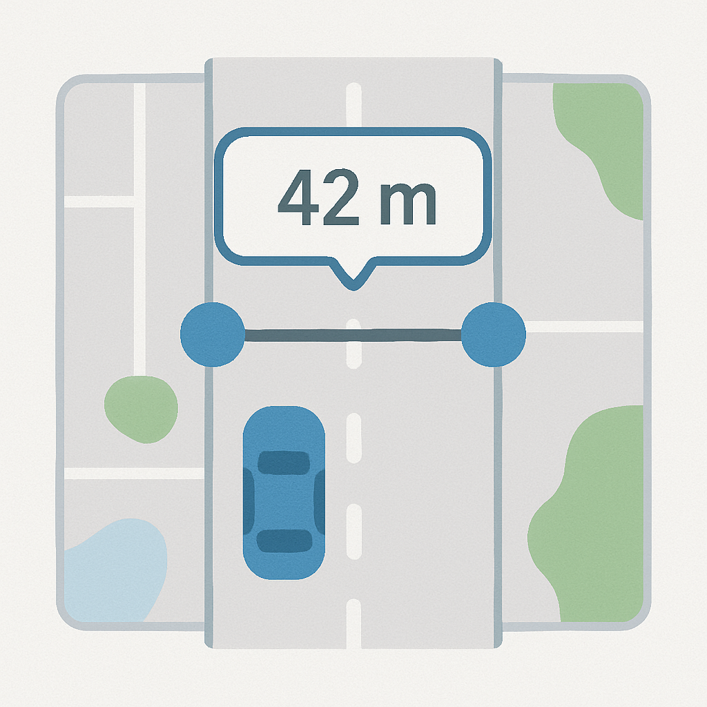
Measurements
Create custom measurements on the go. With measurements, you skip the trip to the field!
LiDAR + Hybrid View
View your LiDAR point cloud and high-res camera imagery side by side—fully synced.
Select a point in one view and see it instantly in the other for faster inspections, clearer context, and better spatial awareness.
Video to 3D
Transform any video into a detailed 3D model in minutes. View, measure, and annotate directly on the model, with full integration into your map for seamless collaboration.

Get in Touch with Us!
Curious about FusionMap? Fill out the form, and our team will get back to you as soon as possible!
- Smart Data at Your Fingertips
- Improved Collaboration
- AI-Powered