In this guide, you will learn how to download a point cloud from FusionMap efficiently
1. Click LiDAR view
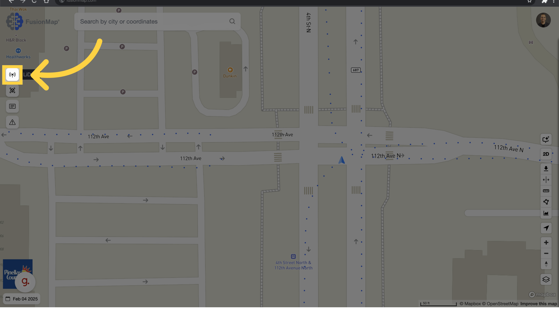
2. LiDAR View
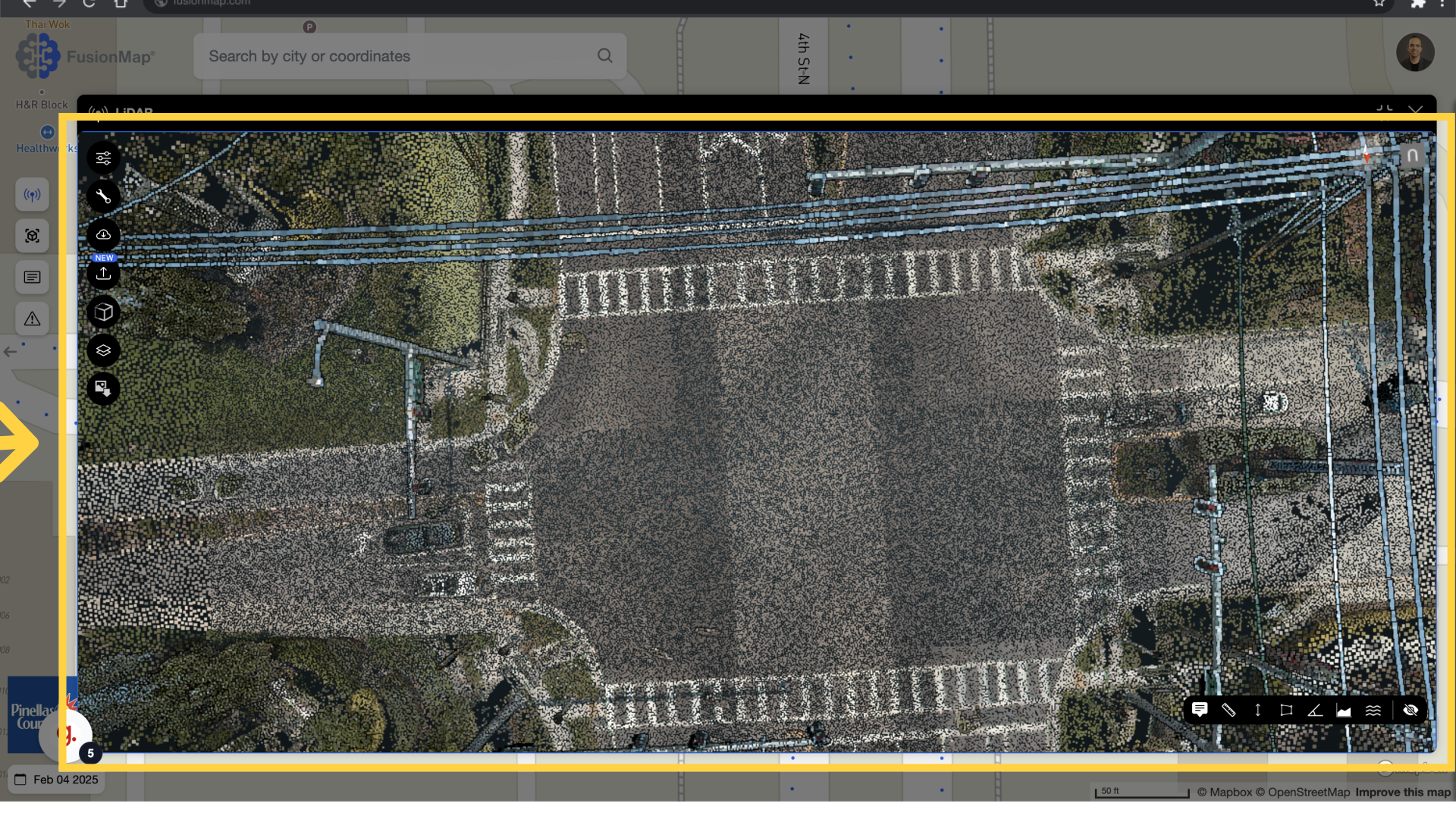
The LiDAR view opens up
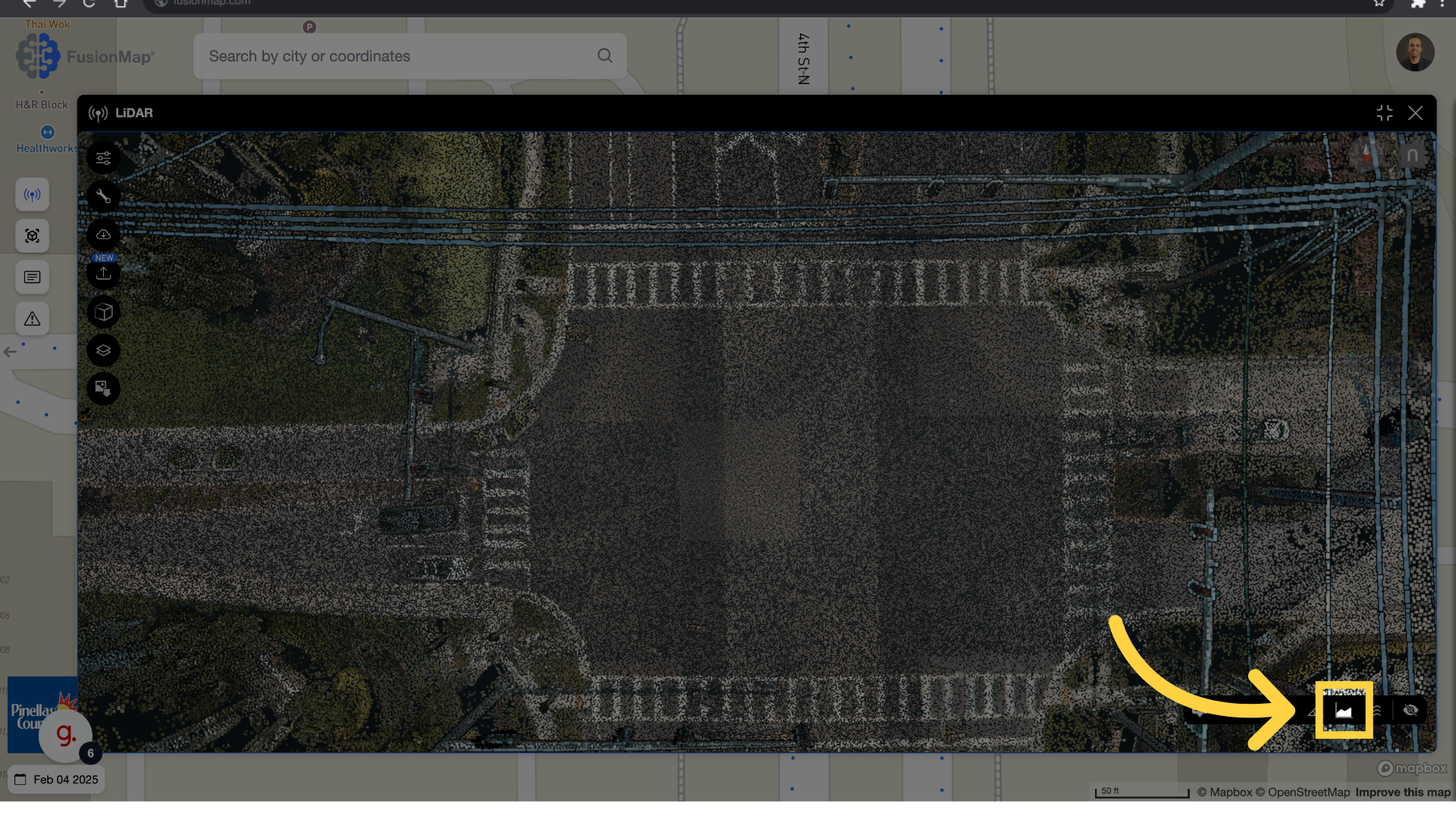
3. Select Height Profile
Click the height profile button
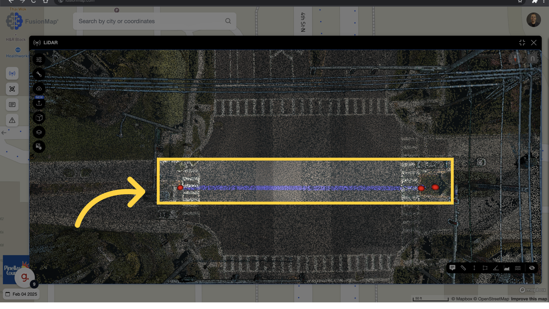
4. Select Start and End
Left click for the start point and right click for the end of the cross section.
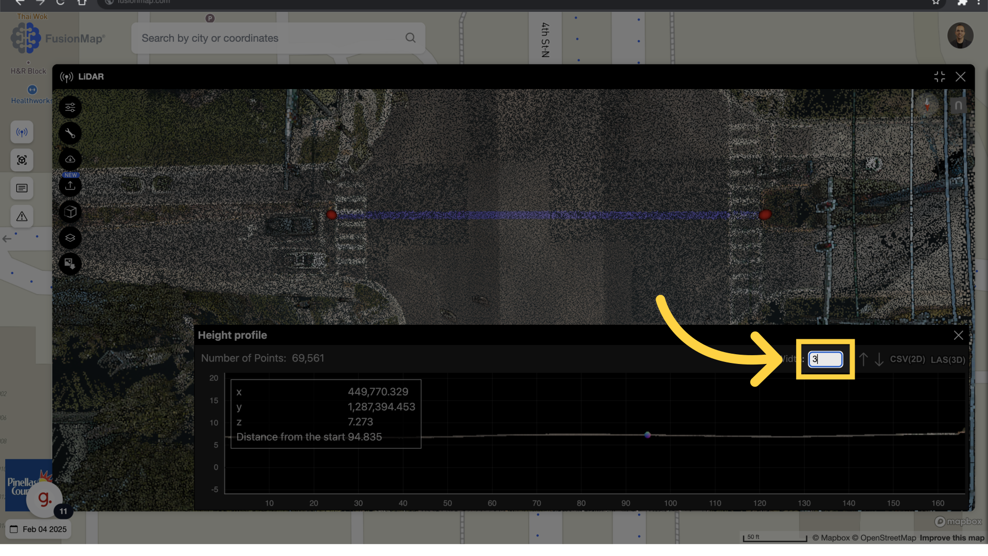
5. Adjust The Width
Change the cross section width to desired value, the unit is based on the lidar pointcloud projection, (imperial or metric)
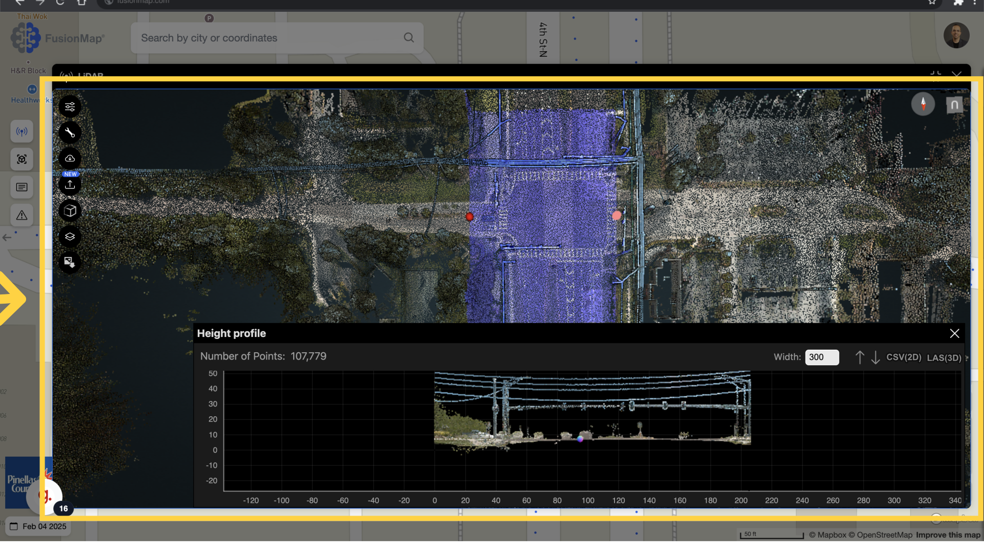
6. Adjust the AOI
you can adjust the area of the interest, marked in blue, interactively.
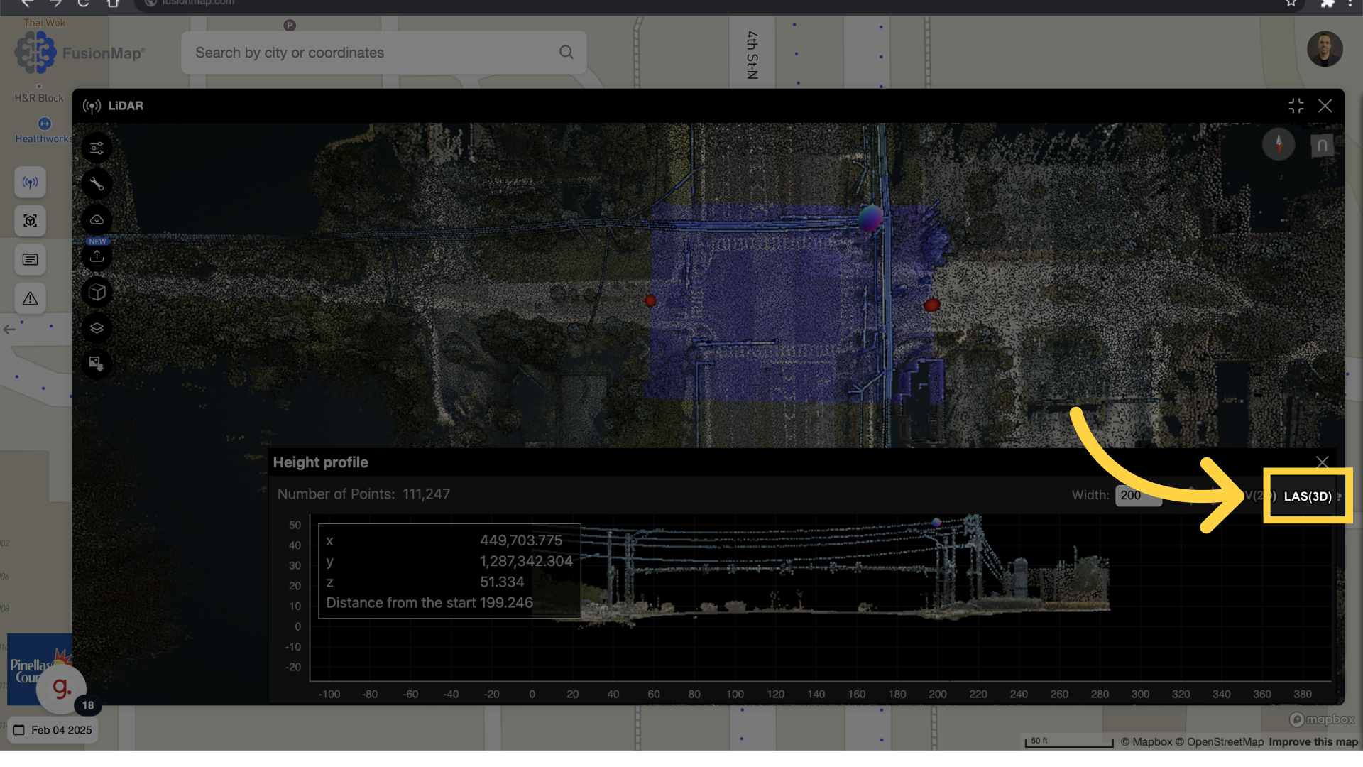
7. Download LAS
Proceed with the download by selecting LAS(3D) from the Heigh Profile Menu.