
Managing Runways, Taxiways, and Airside Infrastructure with Confidence
30+
Major Projects
125k
Miles Analyzed
$5bn
Project Values
50k
Hours Saved
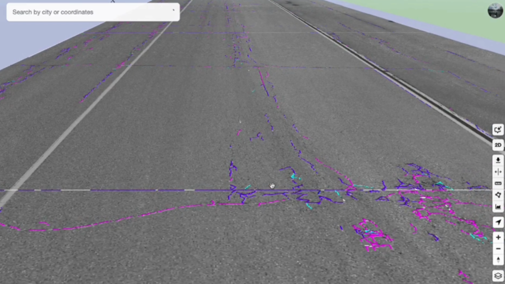
Automated Runway Defect Detection with Airfield AI™
Airfield AI™ analyzes high-resolution imagery and automatically identifies cracks, surface damage, and pavement distress across runways and taxiways.
- Faster, safer inspections without closing runways
- Objective, repeatable defect classification
- Centralized tracking of cracks over time
- Prioritized maintenance based on severity
3D Visualization for Airside Infrastructure
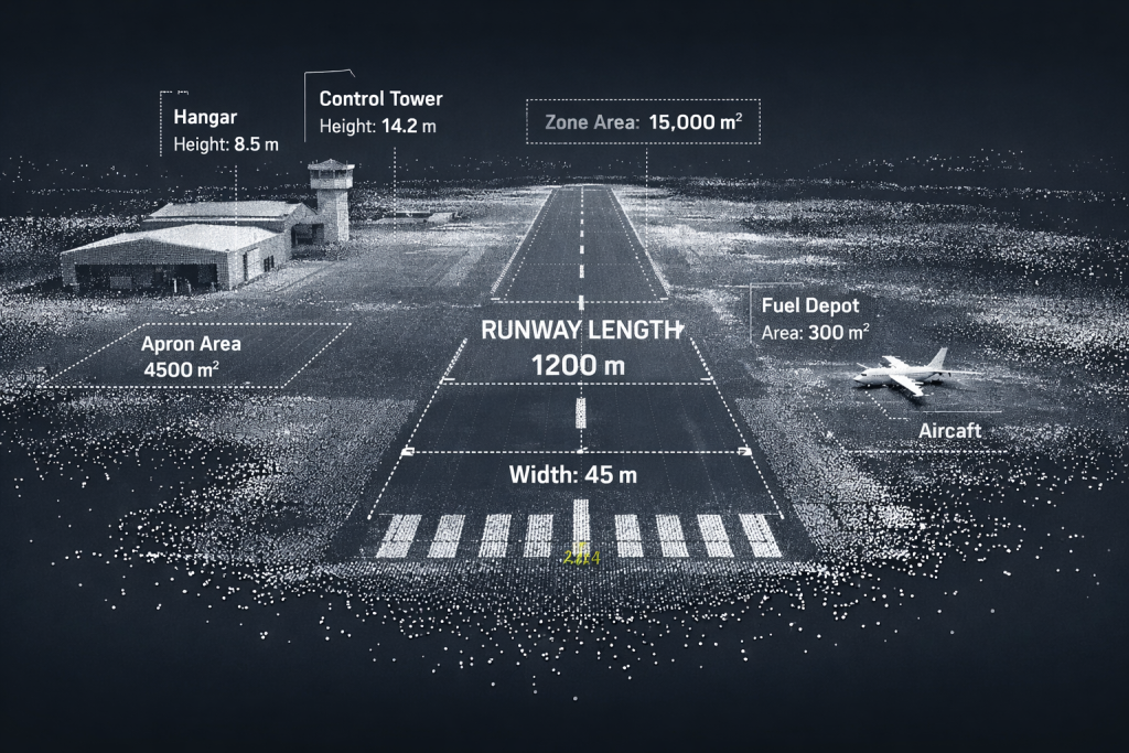
FusionMap’s LiDAR, panoramic, and hybrid viewers give teams a detailed understanding of airport surfaces and structures.
- LiDAR View & Hybrid View for precise 3D inspection
- In-viewer measurements for distances, slopes, and elevations
- Notes & metadata for documenting conditions and maintenance actions
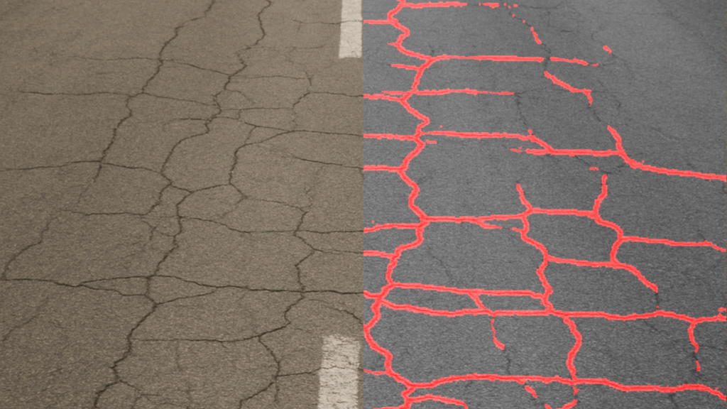
Before/After Analysis for Maintenance & Safety
Whether evaluating surface deterioration or confirming repair work, FusionMap makes comparisons simple.
- Tracking crack progression across inspection cycles
- Verifying completion and quality of resurfacing
- Documenting changes for safety audits
Real-Time Field Updates
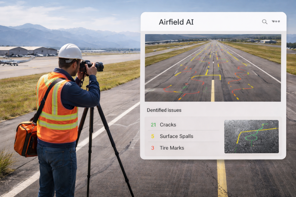
Teams can capture runway photos, inspection notes, and safety observations using the FusionMap iOS app.
- Immediate syncing from field crews to the operations center
- Clear documentation for compliance and reporting
- Reduced data transfer delays during inspection windows
Have a question?
Whether you’re curious about FusionMap, want to schedule a demo, or discuss how it could support your workflows, we’re here to help.
Fill out the form on the right and share a bit about what you’re looking for. Our team will review your message and reach out shortly to continue the conversation.

FusionMap transforms complex data into meaningful maps that make insights easy to explore and share.





Designed with ❤️ by Moosh.