Revolutionizing Disaster Management with FusionMap: A Game-Changer for First Responders
Remote Sensing

- 20 Sep, 2023
- 1.3k Views
- 0 Comment
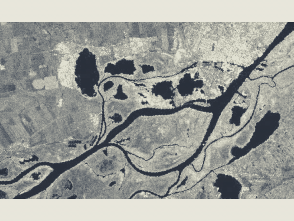
In the face of natural disasters like dam failures, timely and accurate information is critical for decision-makers, emergency responders, researchers, and citizens alike. The recent catastrophic dam failure in Eastern Ukraine underscores the importance of advanced technologies in assessing damages and managing the aftermath of such events. In this blog post, we’ll explore how satellite Synthetic Aperture Radar (SAR) data, combined with Tetra Tech’s powerful FusionMap platform, is transforming the way we monitor and assess flood damages.
Challenges in Flood Mapping with SAR Data:
Using SAR data for flood mapping presents its own set of challenges, particularly in distinguishing water from other dark features like shadows, smooth surfaces, or low vegetation. However, with advancements in technology and image processing techniques, these challenges can be overcome.
Artificial Neural Networks and Self-Organizing Maps:
To effectively distinguish floodwater from other features, advanced image processing techniques, such as artificial neural networks and self-organizing maps, can be employed. These methods allow for the segmentation and classification of SAR images based on pixel values and spatial patterns.
Tetra Tech’s FusionMap: A Game-Changing Solution:
Tetra Tech has developed FusionMap, a cutting-edge web-based platform designed to facilitate easy access and analysis of SAR data for flood monitoring and assessment. This innovative tool integrates multiple sources of satellite data and offers user-friendly tools for visualization and interpretation, making it an invaluable asset for tackling the aftermath of disasters like the dam failure in Eastern Ukraine.
Key Features of FusionMap:
1. User-Friendly Interface: FusionMap’s intuitive interface allows users to select their area of interest, satellite sensor, and time period effortlessly.
2. Flood Mapping with SAR Data:FusionMap harnesses the power of SAR data to generate accurate and up-to-date flood maps, providing a comprehensive view of the flood situation.
3. Additional Layers of Information: Beyond SAR data, FusionMap offers supplementary layers of information such as elevation data, land cover data, population data, and road network data. This additional context enhances the understanding of flood impact and vulnerability.
4. Data Export and Sharing: Users can export flood maps as geospatial files, facilitating seamless integration with other tools and systems. Furthermore, FusionMap allows for easy online sharing of maps with stakeholders, promoting collaboration and informed decision-making.
Empowering Decision-Makers and Responders:
FusionMap is a powerful tool that empowers decision-makers, emergency responders, researchers, and even concerned citizens to monitor and assess damages caused by catastrophic events like the dam failure in Eastern Ukraine. By combining SAR data and FusionMap’s capabilities, users can:
Stay Informed:
Access real-time and accurate flood maps to stay informed about the evolving situation on the ground.
Plan and Coordinate Relief Efforts: Enable efficient allocation of resources and timely deployment of response teams.
Conduct Research:
Researchers can utilize FusionMap to study flood patterns, their environmental impact, and aid in future disaster mitigation efforts.
Engage the Community:
Citizens can be involved by sharing information and raising awareness about flood risks in their areas.
Conclusion:
In the wake of catastrophic events like the dam failure in Eastern Ukraine, access to advanced technologies like SAR data and platforms like FusionMap is indispensable. These tools provide the means to comprehensively monitor, assess, and respond to flood damages, ultimately saving lives and minimizing environmental impact. Tetra Tech’s FusionMap is not just a solution; it’s a transformative force that empowers individuals and organizations to make a difference in disaster management.