Disasters Industry Tab
- Home
- Tab Builder
- Disasters Industry Tab
Disaster Response and Geohazards
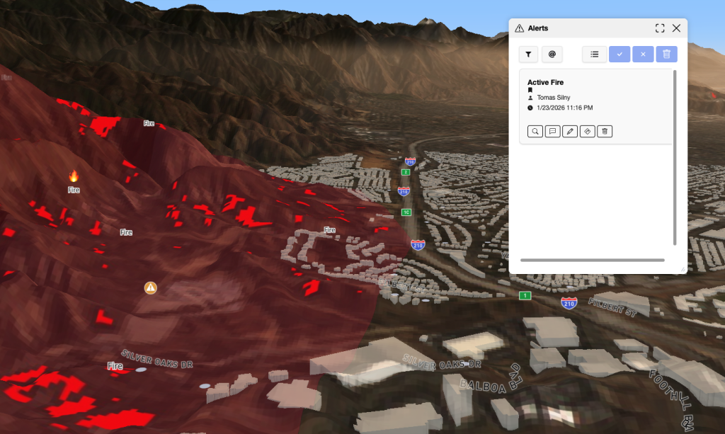
FusionMap enables teams to detect, monitor, and respond to geohazards and disaster events using AI, LiDAR, and imagery. With before-and-after analysis, real-time field updates, and risk visualization, teams can assess impact faster, plan proactively, and respond with confidence.
- AI-powered risk detection – Flood zones, landslides and more
- Visual risk overlays – Map hazards and vulnerable areas
- Planning – Mitigate risk and prepare before disasters strike
- Before/after analysis – Instantly visualize change and damage
FusionMap transforms complex data into meaningful maps that make insights easy to explore and share.


Copyright © Tetra Tech Fusion, LLC. A Tetra Tech company.
Designed with ❤️ by Moosh.
Designed with ❤️ by Moosh.