In the face of natural disasters, innovation becomes the key to resilience and recovery. In the lush paradise of Maui, Hawaii, wildfires have become an increasing threat, endangering both the island’s stunning natural beauty and the communities that call it home. However, hope is on the horizon, thanks to the ground breaking efforts of Tetra…
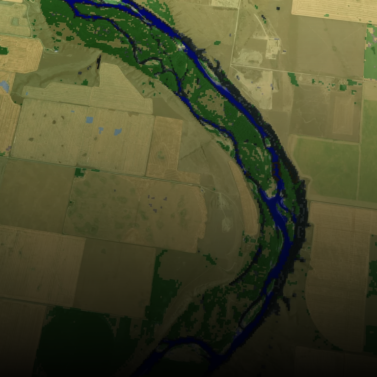
Geohazard Recognition and Mapping with FusionMap
FusionMap harnesses the strengths of LiDAR technology, capable of capturing high-resolution 3D data of terrain and vegetation cover, and combines it with AI technology for efficient and intelligent data processing and analysis.

Unlock Deeper Insights With FusionMap’s Premium Layers
At FusionMap, we know that great decisions start with great data! That’s why we created Premium Layers—a suite of powerful, ready-to-use data layers designed to help you better understand the world around you. Whether you’re monitoring flood events, assessing snow cover, or studying population patterns, Premium Layers delivers critical information right to your map. What…

FusionMap’s Split View: Transforming Disaster Response with Real-Time Clarity
Imagine instantly comparing before-and-after satellite imagery side-by-side. With FusionMap’s Split View, you can do just that—providing critical insights for disaster response from the get-go. Split View: Your Frontline Tool in Crisis FusionMap’s Split View enables rapid change detection with the latest satellite data, helping communities strengthen their resilience against natural disasters. See it in action…

Stay in the Loop: How Mentions in FusionMap Keep Your Geospatial Projects on Track
Collaboration is at the heart of every successful geospatial project, and in a world where teams are managing vast amounts of spatial data, effective communication is key. That’s why we’re excited to introduce Mentions in FusionMap—a feature designed to streamline project discussions and ensure the right people get notified when it matters most. What are…

Introducing Pulse by FusionMap®: Transforming Alerts and Notes with AI
In the fast-paced world of data management, efficiency and accuracy are key. That’s why we’re thrilled to introduce Pulse, the groundbreaking AI assistant now available in FusionMap®. Pulse is set to transform how you create alerts and notes by automating image analysis and description generation, saving you valuable time and enhancing the quality of your…

Discover the Future with FusionMap®’s SplitViewer
Are you ready to witness the world change right before your eyes? With FusionMap’s groundbreaking SplitViewer feature, you can now experience time travel without leaving your desk. This innovative tool allows you to compare two satellite images from different dates side by side, giving you an unparalleled view of how landscapes evolve over time. See…

Introducing the FusionMap “What’s New” Menu: Your Gateway to the Latest Features
We are thrilled to introduce a brand-new feature designed to keep you in the loop with all the exciting updates and enhancements we’re rolling out. Say hello to the FusionMap “What’s New” menu—a dedicated space to discover the latest feature releases, accessible right from the projects page or the map. This feature ensures that you…

Explore Every Detail: Introducing FusionMap® iOS App with Built-in LiDAR Scanner.
In today’s fast-paced world, the demand for innovative solutions that streamline workflows and enhance productivity is ever-growing. At FusionMap™, we’re dedicated to staying ahead of the curve, and our latest offering is no exception. We’re thrilled to introduce the FusionMap® iOS app, equipped with a built-in LiDAR scanner, designed to turn every room into a…
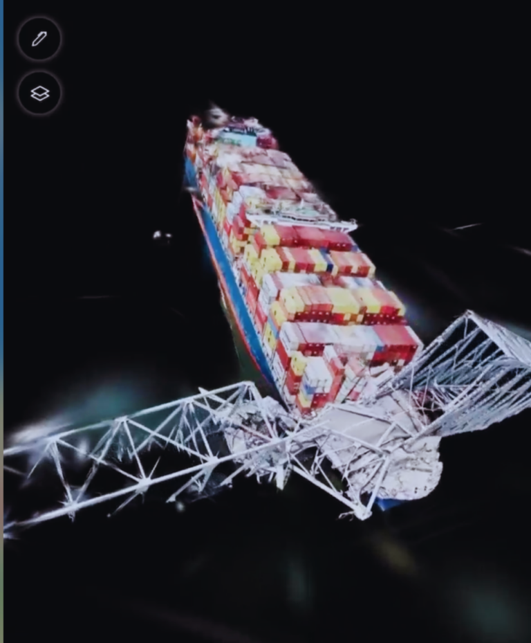
Geospatial Visualization: Transforming any videos into Interactive 3D Scenes with FusionMap® 3DNotes.
In today’s data-driven world, the ability to visualize information in three dimensions is paramount. From urban planning to disaster management, having a comprehensive understanding of spatial data can make all the difference. That’s where FusionMap® 3DNotes comes into play, revolutionizing the way we interact with geospatial information. At FusionMap, we’re dedicated to pushing the boundaries…

FusionMap® Takes Visual Data Analysis to the Next Level with Apple Vision Pro Integration
We are excited to announce that FusionMap®, your trusted web-based application for unifying and analyzing diverse data sources, is now available on Apple Vision Pro. This integration represents a leap forward in accessibility and convenience, offering users an unparalleled data management experience right at their fingertips. Seamless Data Management with Advanced Technology FusionMap® has always…

Transforming Flood Prevention: FusionMap’s Water Detection Solution
Flooding has long been a recurring and financially burdensome challenge for businesses across diverse industries. However, with the advent of the latest web-based technology, a formidable ally has emerged in the battle against this relentless natural threat. Let’s delve into FusionMap, the sophisticated data management platform meticulously crafted by Tetra Tech. This platform promises not…
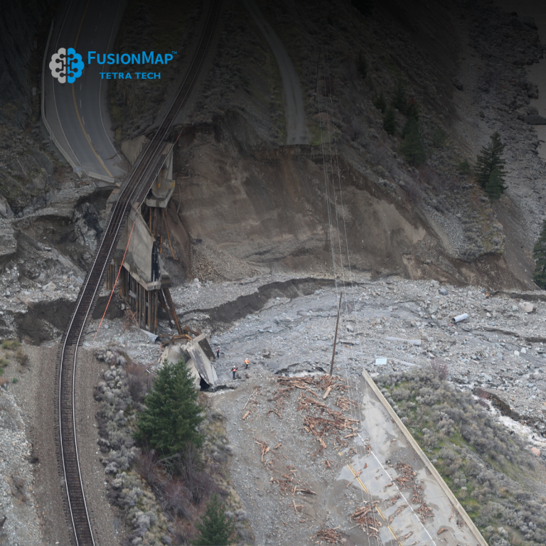
Navigating the Waters: How FusionMap’s Satellite Technology Revolutionizes Water Hazard Monitoring
In an increasingly unpredictable climate, the challenge of protecting linear infrastructure from water-related hazards is paramount. Roads, pipelines, and power lines are the lifelines of our communities, and their safety and integrity are non-negotiable. FusionMap has risen to this challenge, harnessing the power of satellite technology combined with AI-driven insights to offer a groundbreaking solution…

Turning Videos into 3D Models with FusionMap: A New Dimension of Possibilities
In a world driven by data and innovation, FusionMap™ stands out as a cutting-edge web-based application that promises a transformative experience. With the ability to seamlessly consolidate data from diverse sources into one unified platform, FusionMap™ opens up a new dimension of possibilities for businesses and individuals alike. At its core, FusionMap™ is all about…

Leveraging SAR Data and FusionMap to Assess Damages from Catastrophic Dam Failure in Eastern Ukraine
In the face of natural disasters like dam failures, timely and accurate information is critical for decision-makers, emergency responders, researchers, and citizens alike. The recent catastrophic dam failure in Eastern Ukraine underscores the importance of advanced technologies in assessing damages and managing the aftermath of such events. In this blog post, we’ll explore how satellite…

Revolutionizing Disaster Management with FusionMap: A Game-Changer for First Responders
In an ever-changing world, the ability to respond swiftly and effectively to natural disasters is paramount. Lives, property, and entire communities often hang in the balance. That’s where FusionMap comes in—a revolutionary platform that harnesses the power of high-resolution Synthetic Aperture Radar (SAR) data to empower disaster management and first responders. The Power of FusionMap:…

Discover the Future of Mapping with FusionMap™
In a world where data is king, FusionMap™ emerges as a cutting-edge web-based application, redefining the way we interact with geospatial information. With the ability to consolidate data from diverse sources into one unified platform, we’re breaking down the barriers to accessibility and collaboration. Our latest major upgrade introduces a game-changing 3D layer, designed to…

“Unveiling the Power of FusionMap™: A Unified Platform for Privacy and Advanced AI Technology”
In today’s data-driven world, businesses and organizations face the challenge of integrating and managing diverse data sources efficiently. FusionMap™ emerges as the answer to this growing need, offering a cutting-edge web-based application that brings together data from various origins into a single, unified platform. With built-in support for multiple users, tenants, and administrative features, it’s…
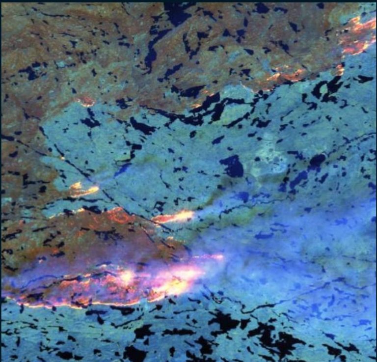
From Sky to Ground: Tracking Wildfires with FusionMap’s Satellite Multispectral Technologies
Tracking the Progress of Wildfires Using Satellite Multispectral Technologies in FusionMap
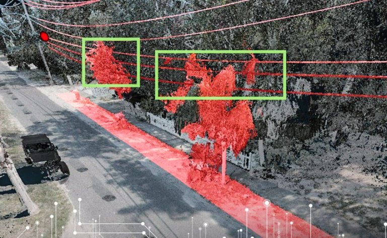
Vegetation Management and Power Utility Clearance Assessments with FusionMap
Vegetation encroachment poses significant risks to power utility infrastructure, including increased outage incidents and safety hazards. FusionMap empowers asset managers by offering advanced vegetation management capabilities:
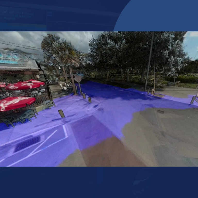
Prevent Flooding with the Latest in Web-Based Technology
In today’s fast-paced world, data is king, and managing it efficiently can be a challenge. This is where FusionMap™ comes into play as a cutting-edge web-based application that promises to revolutionize how you handle data from diverse sources. In this blog, we’ll explore how FusionMap™ can help you prevent “data flooding” and enable seamless collaboration…
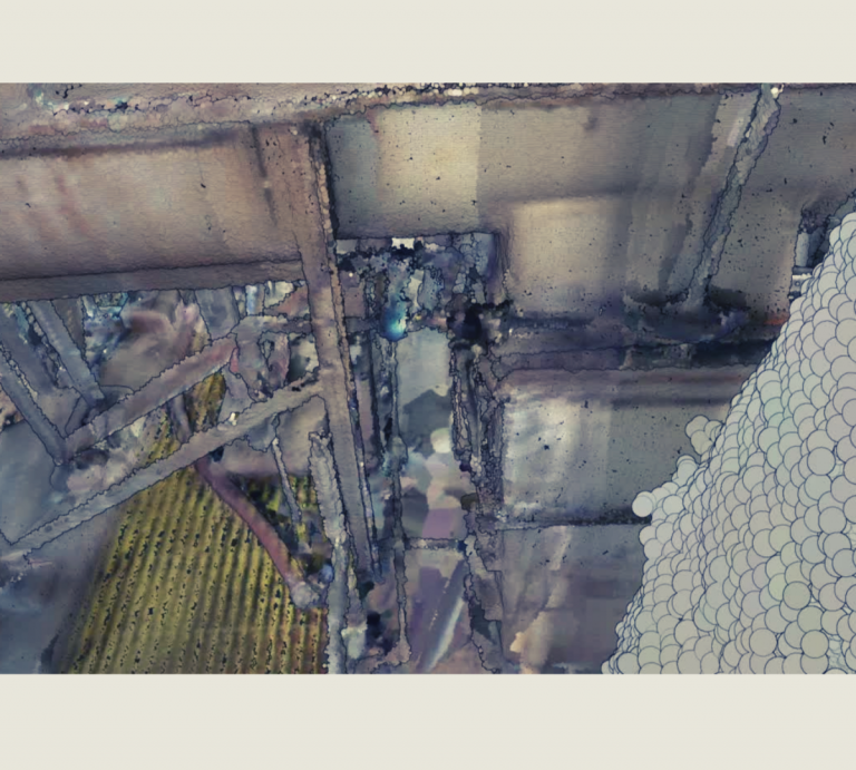
Unlock the Power of Indoor Mapping and Collaborative Insights with FusionMap™
In today’s data-driven world, the need for a unified platform that consolidates data from diverse sources is paramount. This is where FusionMap™ steps in as a cutting-edge web-based application that promises to revolutionize the way you work with data. With built-in support for multiple users, tenants, and robust administrative features, FusionMap™ offers a seamless collaborative…


